

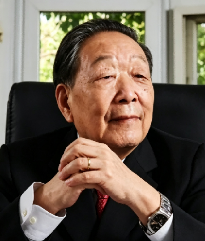
Professor Li’s research has focused on photogrammetry, remote sensing, geographic information systems, and Earth space information science, with particular emphasis on the theoretical foundations and engineering applications of high-precision, high-resolution Earth observation systems. During his doctoral studies in Germany, he developed the theory of error distinguishability and methods for detecting systematic and gross errors, leading to the iterative weight-selection approach known as the “Li Deren Method” for surveying data processing. After returning to China, he led the development of an integrated aerospace–ground 3S system combining remote sensing (RS), satellite positioning (GPS), and geographic information systems (GIS), supporting high-precision mapping at a scale of 1:50,000 without ground control points. His subsequent work has addressed the theoretical development of Earth space information science and the advancement of geographic information technologies and their applications in China. He has authored more than 650 peer-reviewed publications and 11 monographs, and has received the Hansa Luftbild Prize (1988), the Ho Leung Ho Lee Prize for Science and Technology Progress (1999), the Brock Gold Medal of the International Society for Photogrammetry and Remote Sensing (2020 and 2022), and the State Preeminent Science and Technology Award (2023). Through sustained research, leadership of national scientific programmes, and international collaboration, Professor Li has contributed to connecting advances in measurement theory, Earth observation, and geospatial information science with the development of surveying and mapping, spatial information infrastructure, and applications in environmental monitoring and sustainable development.

The International Academy of Eurasian Sciences is an international scientific organisation established in January 1994 and registered in the United Nations as a non-governmental organisation of UNESCO.
International Eurasian Academy of Sciences ASEAN Centre
secretariat@ieasth.org membership@ieasth.org