

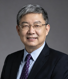
Professor Li’s research has centred on photogrammetry, remote sensing, intelligent transportation systems, and precision engineering surveying, with particular emphasis on mobile mapping, intelligent vehicle navigation, and multi-sensor integration for real-time spatial data acquisition. Through national research programmes and international collaboration, his work has contributed to the development of mobile laser scanning technologies, intelligent transportation systems, and the application of geospatial information science to urban management and disaster response. He has authored numerous peer-reviewed publications and monographs and has received multiple national and ministerial science and technology awards. Through sustained engagement in research, university administration, and international scientific collaboration, Professor Li has contributed to connecting advances in geomatics and geospatial information science with practical applications in smart-city development, intelligent transportation, and sustainable urbanisation.

The International Academy of Eurasian Sciences is an international scientific organisation established in January 1994 and registered in the United Nations as a non-governmental organisation of UNESCO.
International Eurasian Academy of Sciences ASEAN Centre
secretariat@ieasth.org membership@ieasth.org