

International Eurasian Academy of Sciences, IEAS

Academician
Showcase the profiles of Academicians, gathering industry elites and experts to present their professional backgrounds and academic achievements, building an elite platform for member display and communication.
Home / Academician / Academician
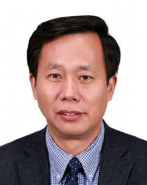
Yaolin LIU
Academician
Yaolin LIU
Profile:
Elected Academician of the International Eurasian Academy of Sciences in 2018, Professor Yaolin Liu is a distinguished Chinese geographic information scientist whose research and professional work have focused on geographic information systems (GIS), spatial analysis, and geospatial applications. Born in September 1960 in Huanggang, Hubei Province, he received his B.S. in Geography from China University of Geosciences in 1982 and his M.S. in Remote Sensing from the same university in 1988, during which year he also undertook advanced studies at the International Institute for Geo-Information Science and Earth Observation (ITC) in the Netherlands. He was selected as a trans-century talent by the State Bureau of Surveying and Mapping in 1995 and by the State Land Administration in 1996, and conducted senior visiting scholar research at Wageningen University in the Netherlands in 1996. In 1997, he was selected as a national-level candidate of the National Hundred-Thousand-Ten Thousand Talent Project and, in 2002, of the Ministry of Education Trans-Century Talent Project, the same year in which he received his Ph.D. in Geo-Information Science from Wageningen University. He subsequently served as Senior Research Fellow at The Hong Kong Polytechnic University in 2004 and was selected as a National Surveying and Mapping Science and Technology Leading Talent in December 2012. He currently serves as Professor at the School of Resource and Environmental Sciences, Wuhan University, and President of Duke Kunshan University.

Professor Liu’s research has centred on GIS theory, methods, and analytical models, with particular emphasis on professional GIS software development, land-use change modelling, and the application of geospatial technologies to natural-resource management and urban planning. Through leadership of national major research programmes and participation in international scientific collaboration, he has contributed to the development of GIS theory, spatial data analysis, land information systems, and geospatial applications in China. His research has addressed the theoretical and methodological foundations of GIS as well as the development and application of software and analytical tools for land-use and spatial planning. Author of numerous peer-reviewed publications and monographs, he has received multiple national and ministerial science and technology awards. Through sustained research, academic leadership, and international collaboration, Professor Liu has contributed to connecting advances in geographic information science and GIS engineering with practical applications in land-resource management, urban planning, spatial information services, and sustainable regional development.
