

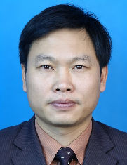
Professor Wu’s research has centred on GIS theory, software, and applications, with particular emphasis on spatial data modelling, 3S integration, spatial information uncertainty, and social sensing. As principal investigator of a national key project on domestic GIS platform development, he led the development of CityStar, an early Chinese GIS platform, and contributed to the development of indigenous GIS software and digital-city technologies. He has led more than twenty national science and technology projects and participated in digital-city and smart-city planning for cities including Beijing and Shenzhen, as well as national informatisation programmes such as Digital Land. His research group introduced the concept of social sensing and developed approaches for analysing spatiotemporal human behaviour and interactions from large-scale data, complementing remote sensing by incorporating information on human activities into spatial analysis and urban management. He has published more than 200 scientific papers and fifteen monographs and holds more than thirty patents and software copyrights, in addition to receiving numerous ministerial- and provincial-level science and technology awards. Through sustained research, software development, and engagement with urban planning and public-sector applications, Professor Wu has contributed to connecting geographic information science with smart-city development and to the development of China’s spatial information industry and digitalisation.

The International Academy of Eurasian Sciences is an international scientific organisation established in January 1994 and registered in the United Nations as a non-governmental organisation of UNESCO.
International Eurasian Academy of Sciences ASEAN Centre
secretariat@ieasth.org membership@ieasth.org